8.5.2024 – day was rainy dark

day was rainy dark
rain fell on the barn roof and
dripped steadily

4 o’clock in the afternoon in the sunny south

The next day was rainy and dark.

Rain fell on the roof of the barn and dripped steadily from the eaves.

Rain fell in the barnyard and ran in crooked courses down into the lane where thistles and pigweed grew.

Rain spattered against Mrs. Zuckerman’s kitchen windows and came gushing out of the downspouts.

Rain fell on the backs of the sheep as they grazed in the meadow.

When the sheep tired of standing in the rain, they walked slowly up the lane and into the fold.

From Charlotte’s Web by EB White.

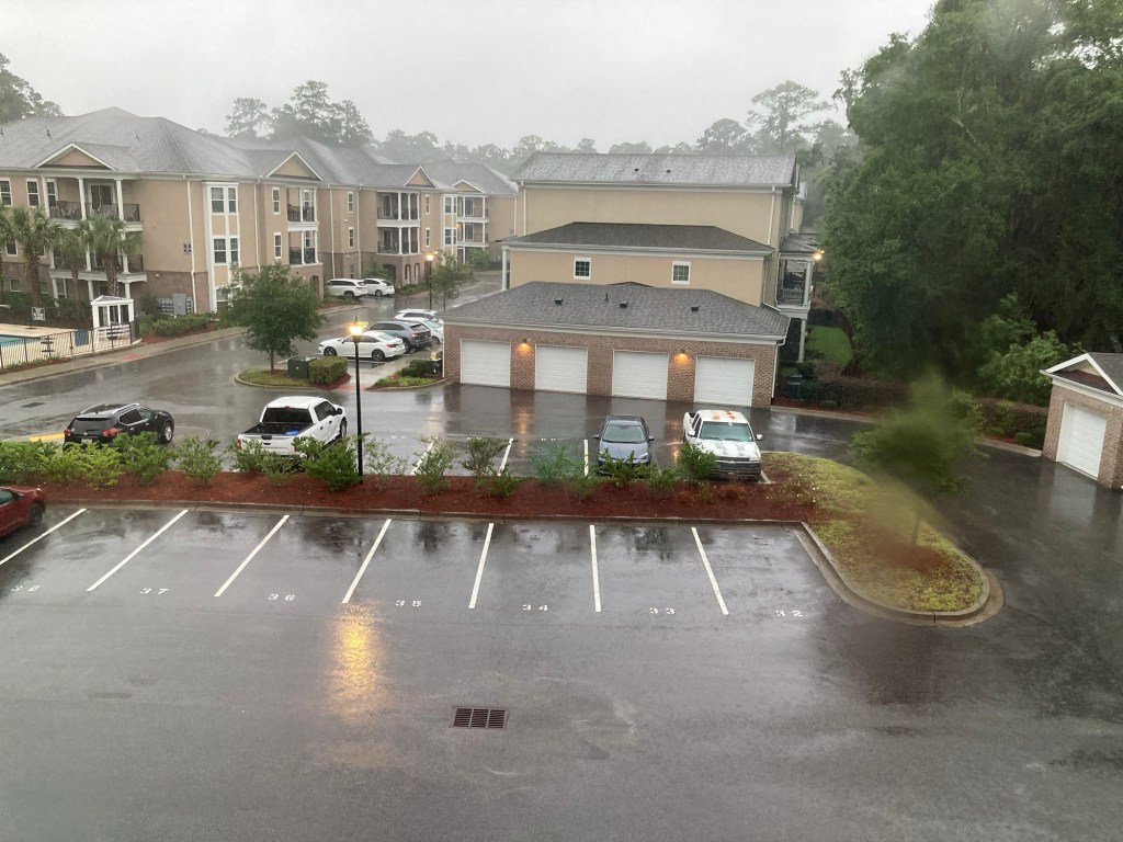
It has been raining all day here in the Low Country of South Carolina and it is supposed to rain for another 2 days.

I have been told to work from home tomorrow and we will see about Wednesday when Wednesday comes.

The rain falls on the roofs of the buildings here in the apartment complex and it drips off the eaves.

We wait for worse things.

Tidal surges.

Power outages.

Mandatory evacuations.

What fun.

We watch and we wait.

Do we have everything powered up if the power goes down?

What do we do without power?

Go to bed early I guess but I don’t want to find out.

For a bit of hope, the passage from Mr. White describes a big day for Wilbur the pig.

After a distressful day of rain and cold and boredom, Wilbur meets Charlotte.

Tomorrow and Tomorrow and Tomorrow.

It will be Thursday before we know it, I hope.

And the rain, rain will have gone away.

8.4.2024 – sailors expression

sailors expression
about weather: the weather
is a great bluffer

As long as there is one upright man, as long as there is one compassionate woman, the contagion may spread and the scene is not desolate. Hope is the thing that is left to us, in a bad time. I shall get up Sunday morning and wind the clock, as a contribution to order and steadfastness.

Sailors have an expression about the weather: they say, the weather is a great bluffer. I guess the same is true of our human society—things can look dark, then a break shows in the clouds, and all is changed, sometimes rather suddenly. It is quite obvious that the human race has made a queer mess of life on this planet. But as a people we probably harbor seeds of goodness that have lain for a long time, waiting to sprout when the conditions are right. Man’s curiosity, his relentlessness, his inventiveness, his ingenuity have led him into deep trouble. We can only hope that these same traits will enable him to claw his way out.

Hang on to your hat. Hang on to your hope. And wind the clock, for tomorrow is another day.

Letter to Mr. Nadeau, March 30, 1973. Letters of E. B. White, Revised Edition. Ed. Martha White. New York: HarperCollins, 2006.

For the first time this hurricane season, folks in the low country are been alerted to the possibility of water … lots of it.

We are are just miles from the Atlantic Ocean which is a lot of water to begin with.

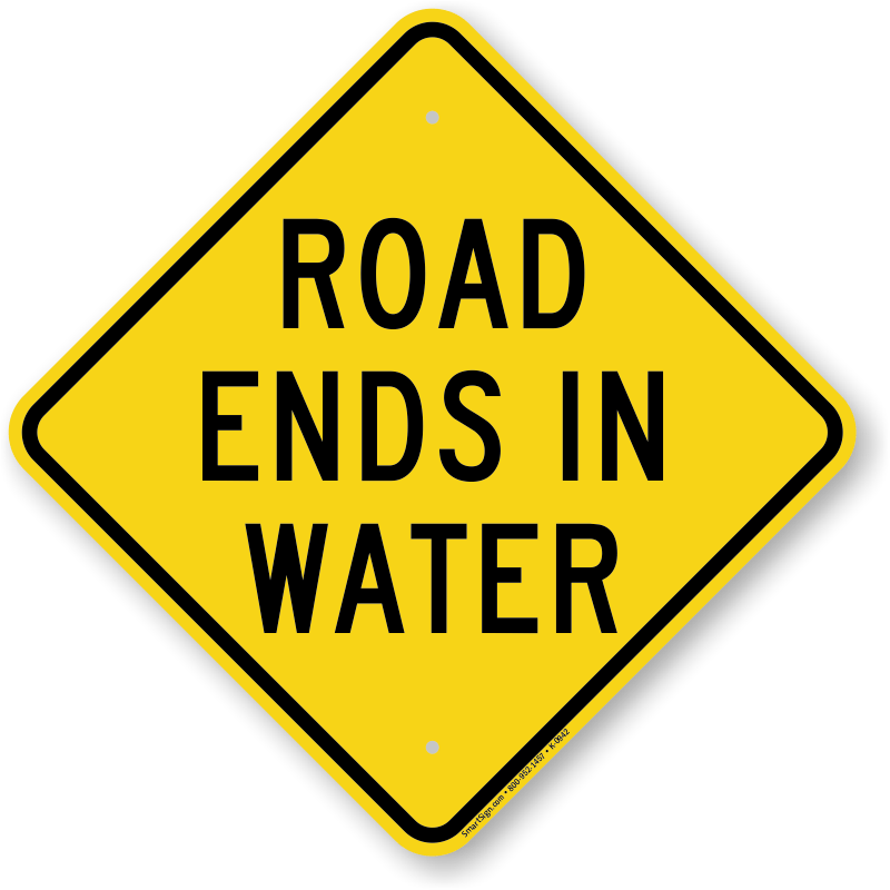
We have roads that with signs that say, “Road Ends in Water.”

I puzzled over these signs for a bit, wondering why they didn’t say, “ROAD ENDS – 500 FT” until I figured it out that in an area with an 8 foot vertical tide, just WHERE the road ends is a matter of time and tide, but for sure, the road ends at the water.

Then a storm, though whether or not its a hurricane or a tropical storm, the weather people or the storm itself hasn’t made up its mind, is coming.

Storms bring storm surges or push more of the Atlantic Ocean up into the low country which is low as the name implies.

I do not worry a lot about storm surge, as I live in Bluffton, which as the name implies, is up on a bluff over the Maye River, it would take a storm surge of some 25 feet or more to get to me.

A storm surge of 10 feet on top of a high tide, would surely strand me here on the bluff as most of the local roads would be covered.

Then there is the coming rain.

Lots of it.

Then there is the malicious nature of this coming storm.

Though the folks who know don’t know what kind of storm it will when the storm is coming they do agree on two things.

One is that it is FULL of rain from the warm waters of the Gulf of Mexico.

The other thing is that the storm will get here to the coast between Savannah and Charleston and … stop.

Not that the raining will stop but the storm will stop and for anywhere between the next 10 to 48 hours, rain of Old Testament Bible stories will fall on us from the heavens.

When you drive through the streets of old Charleston, intersections have depth gauges to show how deep the water can get.

Charleston is about 2 feet about sea level.

During high tide, you can hear water roaring through the storm drains just inches below the road beds.

Drop 6 inches of rain at high tide on Charleston and you can figure out why those depth gauges on intersections have a four foot scale.

On its website, the city of Savannah has posted a city map that show which intersections will be flooded.

Savannah is also on a bluff above the Savannah River but it also has a storm water sewage system that is about 100 years old.

Some schools are already closing for the day, Wednesday.

And all of this is speculation.

I have worked with enough weather people to know that nobody knows nothing when it comes to forecasting.

As Mr. White writes, the weather is a great bluffer.

But we all take warning.

And as Mr. White writes, I guess the same is true of our human society—things can look dark, then a break shows in the clouds, and all is changed, sometimes rather suddenly. It is quite obvious that the human race has made a queer mess of life on this planet.

I take heart both for the storm and the mess of life that the human race has made on this planet when I consider:

But as a people we probably harbor seeds of goodness that have lain for a long time, waiting to sprout when the conditions are right. Man’s curiosity, his relentlessness, his inventiveness, his ingenuity have led him into deep trouble. We can only hope that these same traits will enable him to claw his way out.

4.7.2024 – dimmed the daylight

dimmed the daylight
made darkness come upon us
noon and the sunshine

Nothing will surprise me anymore, nor be too wonderful
for belief, now that the lord upon Olympus, father Zeus,
dimmed the daylight and made darkness come upon us in the noon
and the sunshine. So limp terror has descended upon mankind.
After this, men can believe in anything. They can expect
anything. Be not astonished any more, although you see
beasts of the dry land exchange with dolphins, and assume their place
in the watery pastures of the sea, and beasts who loved the hills
find the ocean’s crashing waters sweeter than the bulk of land.

Poetry fragment by Archilochus of Paros, [8th-7th century] in Iambi et elegi Graeci ante Alexandrum cantati, M.L. West, ed.  (Oxford, Oxford University Press, 1989)

Total eclipse of the sun on Monday.

After this, men can believe in anything.

They can expect anything.

3.13.2024 – oh the rains came down

oh the rains came down
the floods came up, it was gone
in seventy two hours

An affluent group of beachfront property owners in Salisbury, Massachusetts – a coastal town 35 miles north of Boston – are mourning the loss of their investment after a safety measure they took to protect their homes failed.

The dune, made of 15,000 tons of sand, was meant to keep dangerous tides from encroaching on to the shore and damaging beach houses. The dune had just been completed in February but was gone within 72 hours.

From the article, “Swept away: $500,000 sand dune built to protect US homes disappears in days” by Erum Salam, March 13, 2024.

Don’t tell me those hours in Sunday School were wasted hours.

3.2.2024 – further furthermore

further furthermore
moreover meanwhile and
additionally

This morning I read the article, ‘We knew this was coming’: western US hunkers down amid avalanche warnings and gale-force winds” by Nina Lakhani and Dani Anguiano in the Guardian (March 1, 2024) and I got hung up by the quote from the National Weather Warning that stated:

There is a high chance (over 70%) of substantial, long-lasting disruptions to daily life in the higher elevations of the Sierra Nevada Mountains Friday-Saturday, where blizzard conditions and 5+ feet of snow are expected.

I liked the idea of … a high chance of substantial, long-lasting disruptions to daily life … through Saturday.

And I wrote this haiku:

high chance substantial,
long-lasting disruptions to
daily life expected

I guess that it means that the substantial, long-lasting disruptions to daily life could HAPPEN through Saturday but the substantial, long-lasting disruptions to daily life could LAST much longer than just through the weekend.

On the other hand, my wife pointed out that 24 to 48 hour power/cellphone/internet/TV outage WAS a substantial, long-lasting disruption to daily life for a lot of people today.

I went and read the complete Short Range Public Discussion Weather Statement from the NWS.

As this blog and these haiku are meant to be about words, I have to take my hat off and applaud those folks at the National Weather service for the all inclusive text in their Short Range Public Discussion.

The Short Range Public Discussion consists of 4 bullet points and seven paragraphs.

The first paragraph starts out with, “A second winter storm will impact the West Coast …”

The following six paragraphs start as follows:

Furthermore, the storm will …

Moreover, in addition to …

In addition, the …

Further, cold air will …

Meanwhile, upper-level energy …

And finally, Additionally, upper-level energy moving …

With a “Also, on Friday …” tucked into the last paragraph.

I don’t know but there something hypnotic, something Shakespearian, like a bass note in a Bach fugue as each new aspect of this storm is introduced into the Short Range Public Discussion of the weather.

I can easily imagine it as a rant of someone in a movie or tv show spouting off on all the things that went wrong on their weekend off.

It was Oscar Wilde who said, “Conversation about the weather is the last refuge of the unimaginative.”

Well!

Mr. Wilde never met the United States National Weather Service.

PS – OH AND, here is the complete Short Range Public Discussion as it appeared on Thursday, February 29, 2024 at 2:58AM (EST).

Short Range Forecast Discussion
NWS Weather Prediction Center College Park MD
258 AM EST Thu Feb 29 2024

Valid 12Z Thu Feb 29 2024 – 12Z Sat Mar 02 2024

…Heavy snow over parts of the Cascades, the Northern Intermountain

Region, Northern Rockies, Northern California, and Sierra Nevada
Mountains…

…Heavy lake-effect snow southeast of Lake Ontario and over the Upper
Great Lakes…

…Rain from the Gulf Coast to parts of northern Mid-Atlantic and shower
and thunderstorms along the Central Gulf Coast and Southeast…

A second winter storm will impact the West Coast on Thursday and Friday. The storm will create heavy mountain snow that will affect many passes. Multiple feet of snow are likely (over 80% chance) for higher elevations, especially above 5000 feet, including many Cascade and Sierra Nevada Mountain passes. Extremely heavy snow rates surpassing 3 inches per hour are likely.

Furthermore, the storm will produce blizzard conditions in the Sierra Nevada Mountains. In detail, strong winds will cause significant blowing/drifting snow and whiteout conditions, making travel impossible in the Sierra Nevada Mountains. There is a high chance (over 70%) of substantial, long-lasting disruptions to daily life in the higher elevations of the Sierra Nevada Mountains Friday-Saturday, where blizzard conditions and 5+ feet of snow are expected.

Moreover, in addition to the snow, coastal rain will develop over parts of the Pacific Northwest Thursday into Saturday. Coastal rain will develop over parts of California Thursday morning, continuing into Saturday.

In addition, the widespread damaging wind will develop over the Western U.S. Wind gusts of 55+ mph are forecasted across much of the West, particularly across higher elevations and the Intermountain West, where 75+ mph gusts are possible. These winds would likely down trees and power lines, resulting in power outages across affected areas.

Further, cold air will lower snow levels Friday into Saturday. As the storm moves south, snow levels will lower into some Northern California and Sierra Nevada Mountain foothill communities. Much colder air is forecast for Saturday, with temperatures 10-20 degrees below normal.

Meanwhile, upper-level energy moving across the Great Lakes into the Northeast will create lake-effect snow over the northeast portion of the U.P. of Michigan, with the heaviest lake-effect snow southeast of Lake Ontario on Thursday.

Additionally, upper-level energy moving over the Southern Rockies will move eastward to the Mid-Atlantic by Saturday, producing rain and higher-elevation snow over the Southern Rockies Thursday. Overnight Thursday, showers and thunderstorms will develop over parts of the Southern Plains, moving into the Lower Mississippi, Tennessee, and Southern Ohio Valleys and parts of the Southeast by Friday. The showers and thunderstorms will continue over parts of the Southeast through Saturday. On Friday, rain will move into parts of the Mid-Atlantic and Ohio Valley, moving into parts of the Northeast by Saturday. Also, on Friday, scattered pockets of rain/freezing rain will develop over the highest elevations of parts of the Central/Southern Appalachians.