everybody voiced profound, resigned hopelessness white fog blanketing
Adapted from the article, ‘Profound, resigned hopelessness’: people across US and Canada share effects of wildfire smoke, sub headed … Air quality in North America has plummeted, affecting the health of millions of people across the continent by Marina Dunbar in the Guardian on Sunday, July 19, 2026, where Ms. Dunbar writes:
South of the Canadian border, residents who made even brief trips outside described air conditions as noxious. Chicago recorded the world’s worst air quality on Thursday evening, according to IQAir’s global rankings, with Detroit and Minneapolis also ranking among the most polluted cities.
In Skokie, Illinois, 26-year-old student Zeff said the smoke carried a pungent chemical smell.
“The air stinks of burnt plastic, like it’s been poisoned,” he said. “It’s impossible to take a deep breath without my nose and throat burning.”
He said the ominous haze has settled over neighborhoods throughout the day.
“There’s a mirage hanging on the treetops, white fog blanketing everything in the distance,” he said. “Everybody I speak to voices a profound, resigned hopelessness.”
An analogy for today?
Life imitates life?
It IS almost perfect isn’t it?
There’s a mirage hanging on the treetops.
A white fog blanketing everything in the distance.
Everybody voices a profound, resigned hopelessness.
old foole, unruly Sunne, why dost thou thus through windows, through curtaines call on us?
For midsummers day I wanted a photo of the sun at its highest point on the compass for sunrise … and it rained so this a photo from last week when I did catch the moments just after sunrise.
But as I checked and found out that midsummers day and the summer solstice may not mean the same thing to all people, I thought, oh well.
Anyway for the longest day of the year or the day with the most sunlight, if the sun is out, here is John Dunne’s The Sun ne Rising, from 1633.
I list it first it was it close to the english of the day and then a more modern spelling.
I will point that even 400 years ago, no one wanted to get up.
The Sunne Rising
Busie old foole, unruly Sunne, Why dost thou thus, Through windowes, and through curtaines call on us? Must to thy motions lovers seasons run? Sawcy pedantique wretch, goe chide Late schoole boyes, and sowre prentices, Goe tell Court huntsmen, that the King will ride, Call countrey ants to harvest offices; Love, all alike, no season knowes, nor clyme, Nor houres, dayes, moneths, which are the rags of time.
Thy beames, so reverend, and strong Why shouldst thou thinke? I could eclipse and cloud them with a winke, But that I would not lose her sight so long: If her eyes have not blinded thine, Looke, and to morrow late, tell mee, Whether both the’India’s of spice and Myne Be where thou leftst them, or lie here with mee. Aske for those Kings whom thou saw’st yesterday, And thou shalt heare, All here in one bed lay.
She’is all States, and all Princes, I, Nothing else is. Princes doe but play us; compar’d to this, All honor’s mimique; All wealth alchimie. Thou sunne art halfe as happy’as wee, In that the world’s contracted thus; Thine age askes ease, and since thy duties bee To warme the world, that’s done in warming us. Shine here to us, and thou art every where; This bed thy center is, these walls, thy spheare.
As published in The complete English poems of John Donne by John Donne, Edited by C. A. Patrides is G. B. Harrison Professor of English Literature in the University of Michigan at Ann Arbor. (London: Dent Collection, 1985).
The Sun Rising By John Donne
Busy old fool, unruly sun, Why dost thou thus,
Through windows, and through curtains call on us? Must to thy motions lovers’ seasons run? Saucy pedantic wretch, go chide Late school boys and sour prentices, Go tell court huntsmen that the king will ride, Call country ants to harvest offices, Love, all alike, no season knows nor clime, Nor hours, days, months, which are the rags of time.
Thy beams, so reverend and strong Why shouldst thou think?
I could eclipse and cloud them with a wink, But that I would not lose her sight so long; If her eyes have not blinded thine, Look, and tomorrow late, tell me, Whether both th’ Indias of spice and mine Be where thou leftst them, or lie here with me. Ask for those kings whom thou saw’st yesterday, And thou shalt hear, All here in one bed lay.
She’s all states, and all princes, I, Nothing else is.
Princes do but play us; compared to this, All honor’s mimic, all wealth alchemy. Thou, sun, art half as happy as we, In that the world’s contracted thus. Thine age asks ease, and since thy duties be To warm the world, that’s done in warming us. Shine here to us, and thou art everywhere; This bed thy center is, these walls, thy sphere.
Why was it sunny and warm one morning in New York, only to be snowing by the afternoon? Why did the Great Lakes face tornadoes one day and blizzard conditions not long after? Why can’t the temperature make up its mind?
The answer is simple: It’s March.
The month has long been notorious in meteorology circles as the volatile transition from winter to spring, bringing rapid shifts in temperature. You’ve probably heard the proverb: It’s the month that comes in like a lion and goes out like a lamb.
But even by March standards, this one has been especially harsh, and no corner of the country seems to have been spared the chaotic weather.
“In that way, the recent weather extremes — severe weather in the Midwest, high snowfall in the Great Lakes, record-breaking temperatures in the East, and fires in the Plains — are not unheard-of this time of the year,” Mr. Ford said.
But there is always a “but” when scientists discuss weather extremes.
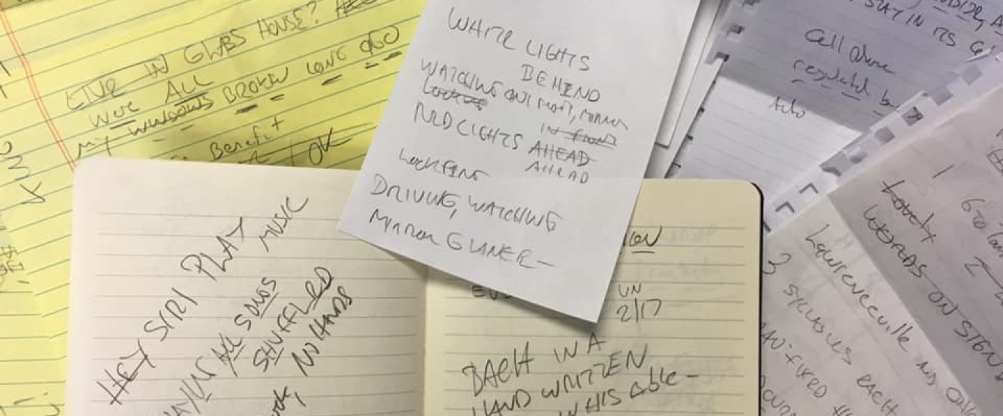
For 20 years I worked bringing TV news and weather online.
I pioneered a lot of stuff that is now accepted as common place.
I worked with Meteorlogists to overlay live radar on maps showing the location of area high school football games.
We recreated the seven day forecast in multiple languages.
I helped launched the great WXIA-11 WIZOMETER!
And I learned a few things.
One was this rule.
The seventh day of the seven day forecast is always warm and sunny.
eventually weekends end reality sparks the sunday scaries
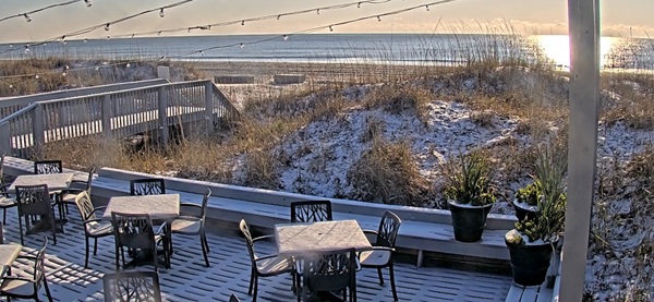
White Rainbow, Folly Beach, Hilton head Island, SC 3.7.2026
Readers of this blog will remember that on Saturday I enjoy the Guardian column, Blind Date, where the newspaper sets up a blind date between two volunteers at some posh (always wanted to use that word) dining establishment (can’t say just restaurant because the blind date might be at a pub, bistro, brasserie or just plan diner) and then the two volunteers are asked to answer questions about the blind date.
As this takes place in Britain, I enjoy the language and the menus of the dining establishment.
As for the menus, yesterdays Blind Date took place at the Cargo Cantina in Bristol.
Their website says, “CARGO Cantina is inspired by the authentic Cantinas of Mexico, traditionally forbidden to women, children and men in police or military uniform, where hombres used to drink around the bar and have some botanas (bar snacks).”
The first click on the menu, much like and online menu here in the USA, lands you on a page that says, ORDER BY GET GRUB or UBER EATS.
Again, as this is in Britain, you are invited to place your order via … Deliveroo!
Not kidding.
Deliveroo!
Is that not faboulous?
In a country where the bathroom is referred to as a loo, the online food delivery service is deliveroo.
Just gets you mind going doesn’t it.
Usually I find really goofy food choices on the menu like Singing Hinnies or Cullen Skink but this menu was straight forward Mexican with tacos, burritos and such but with a twist like Smoked Carrot Tostadas.
There was a nice note at the bottom of the menu that stated, 50p from each sale of our TORTILLA CHIPS + SALSAS are given to support Casita de Barro in Puebla. This is an educational project which creates sustainable living opportunities for communities in the local area.
There was also a warning that Cargo Cantina was a CASHLESS venue, meaning they only accept plastic which is different as we are seeing more and more restaurants here going cash only.
But enough about Casa Cantina as I DIGRESS.
Yesterdays Blind Date was with Harry, 24, an ecologist, and Freya, 24, a theatre-maker and cook.
The first question asked of the volunteers is “What were you hoping for?”
Harry responded, Some tasty food, and a nice evening with good company to block out the Sunday scaries.
The Sunday Scaries?
The Sunday Scaries?
Hadn’t heard of that one.
I have heard of “The Mondays”.
As in the movie, Office Space where Peter says “I gotta get out of here. I think I’m gonna lose it.”
And Nina, a co-worker says, “Uh oh. Sounds like somebody’s got a case of the Mondays.”
Later Peter asks his next door neighbor Lawrence (who he talks to through the paper thin walls of their side-by-side apartments, “Let me ask you something. When you come in on Monday and you’re not feeling real well, does anyone ever say to you, “Sounds like someone has a case of the Mondays?”
Lawrence replies (through the wall), “No. No, man. Shit, no, man. I believe you’d get your ass kicked sayin’ something like that, man.”
So I was thinking that somehow the Sunday Scaries could be related to having a case of the Monday’s but on the side of the Atlantic.
I open The Google and typed in Sunday Scaries and there it was …
If you’re a Monday-to-Friday worker, your two favorite days of the week probably begin with the letter S. Fun thrives on Saturday and Sundays, after all. It’s a two-day stretch with no job responsibilities.
But weekends eventually end — and as a new work week closes in, that looming reality can spark a growing dread known as the “Sunday scaries.”
As in the Cleveland Clinic about which Wikipedia states: Cleveland Clinic is an American nonprofit academic medical center based in Cleveland, Ohio. Owned and operated by the Cleveland Clinic Foundation, an Ohio nonprofit corporation, Cleveland Clinic was founded in 1921 by a group of faculty and alumni from the Case Western Reserve University School of Medicine. Cleveland Clinic is consistently ranked as one of the best hospitals in the United States.
The Cleveland Clinic, one of the best hospitals in the United States, recognizes the Sunday Scaries as a real malady.
The Cleveland Clinic says:
“The transition from weekend relaxation to work mode can be a tough 180-degree turn,” she continues. “In that way, Sunday scaries are a normal reaction to adjusting to a different role and change.”
Plus, let’s be honest here: Work can be nerve-wracking. In fact, 83% of employees in the United States report feeling workplace stress.
“Work is one of those things people get anxious about because we don’t have control over so much of it,” adds Dr. Prewitt. “That can lead to negative thoughts and fears and worries about what’s ahead.”
And the Cleveland Clinic offers these 10 suggestions to chase away your worries about Monday.
Adopt a positive mindset: Negative thoughts can fuel the Sunday scaries. So, instead of thinking, “I don’t want to go to work tomorrow,” fill your mind with encouraging affirmations like, “I can do this” or “I’m ready to get back to it.” Keep busy: Schedule a fun activity on Sunday. Running errands or crossing tasks off your to-do list can help keep your mind off Sunday, too. Either can leave you feeling satisfied. Break a sweat: Exercise releases feel-good endorphins that can brighten your mood. Heading to a park for some hiking or the gym for a lifting session can give you the strength to take on Monday. Clear your head: Practicing mindfulness can be calming and help put you in the moment during the weekend. Try meditation, yoga or get that massage you’ve been wanting. Catch some ZZZs: Tired is no way to go into a new work week. Use the weekend to catch up on lost sleep and recharge your batteries. (Just don’t sleep too much, as that can bring its own set of problems.) Aim for a fresh start: Do your best to wrap up work tasks BEFORE you clock out on Friday. That can keep things from lingering in your head during your days off. Treat yourself: Give yourself something to look forward to on Sundays and Mondays. Maybe that means a nice dinner with friends or family to end the weekend or a coffee from your favorite café on the way back to work. Make Mondays easier: Reduce start-of-the-week worries by embracing the concept of “Bare Minimum Mondays” and easing back into job duties with simpler tasks. Plan ahead: Jotting down a to-do list for when you get back to work on Monday may help release your worries about what’s to come. (Just make sure you keep the list out of your head once it’s written!) Detach from work: If possible, try to avoid doing work over the weekend to fully separate yourself from your job. That email can wait until Monday.
There you have it.
10 tips to avoid those Sunday Scaries and help prevent a case of Mondays.
Personally, I believe you’d get your ass kicked sayin’ something like that, man.
Also, for myself, was on the beach on Hilton Head Island yesterday.
There was a lot of moisture in the air though not quite fog.
And overhead was a white rainbow.
In the Book of Genesis, The Bible tells us that:
I have set my rainbow in the clouds, and it will be the sign of the covenant between me and the earth.
Whenever I bring clouds over the earth and the rainbow appears in the clouds, I will remember my covenant between me and you and all living creatures of every kind.
Never again will the waters become a flood to destroy all life.
Whenever the rainbow appears in the clouds, I will see it and remember the everlasting covenant between God and all living creatures of every kind on the earth.
Always a comfort to read and to see a rainbow in the sky.
Though there is the question about the rainbow being white.
Never saw that before.
Could it mean something?
Here come those Sunday Scaries.
We could be set up for a real bad case of the Mondays.
BTW: I was kidding when I said White Rainbow but according to Wikipedia I was right. Wikipedia says, A fog bow, sometimes called a white rainbow, is a phenomenon similar to a rainbow; however, as its name suggests, it appears as a bow in fog rather than rain. Because of the very small size of water droplets that cause fog—smaller than 0.05 millimeters (0.0020 in)—the fog bow has only very weak colors, with a red outer edge and bluish inner edge. The colors fade due to being smeared out by the diffraction effect of the smaller droplets.
Winter Storm Warning Including the cities of Hilton Head Island
URGENT – WINTER WEATHER MESSAGE National Weather Service Charleston SC 1236 PM EST Sat Jan 31 2026
GAZ087-088-SCZ040-042-043-049-010145- /O.CON.KCHS.WS.W.0001.000000T0000Z-260201T1800Z/ Jenkins-Screven-Allendale-Hampton-Inland Colleton-Coastal Colleton- Including the cities of Sylvania, Yemassee, Hampton, Allendale, Millen, Edisto Beach, and Walterboro 1236 PM EST Sat Jan 31 2026
…WINTER STORM WARNING REMAINS IN EFFECT UNTIL 1 PM EST SUNDAY…
WHAT…Heavy snow expected. Total snow accumulations between 2 and 4 inches.
WHERE…In Georgia, Jenkins and Screven Counties. In South Carolina, Allendale, Coastal Colleton, Hampton, and Inland Colleton Counties.
WHEN…Until 1 PM EST Sunday.
IMPACTS…Travel could be very difficult.
PRECAUTIONARY/PREPAREDNESS ACTIONS…
If you must travel, keep an extra flashlight, food, and water in your vehicle in case of an emergency. The latest road conditions for the state you are calling from can be obtained by calling 5 1 1.
&&
$$
GAZ099>101-SCZ047-048-051-010145- /O.CON.KCHS.WS.W.0001.000000T0000Z-260201T1800Z/ Candler-Bulloch-Effingham-Inland Jasper-Beaufort-Coastal Jasper- Including the cities of Hilton Head Island, Chelsea, Ridgeland, Jasper, Springfield, Beaufort, Levy, Rincon, Metter, and Statesboro 1236 PM EST Sat Jan 31 2026
…WINTER STORM WARNING REMAINS IN EFFECT UNTIL 1 PM EST SUNDAY…
WHAT…Heavy snow expected. Total snow accumulations up to two inches.
WHERE…In Georgia, Bulloch, Candler, and Effingham Counties. In South Carolina, Beaufort, Coastal Jasper, and Inland Jasper Counties.
WHEN…Until 1 PM EST Sunday.
IMPACTS…Travel could be very difficult.
PRECAUTIONARY/PREPAREDNESS ACTIONS…
If you must travel, keep an extra flashlight, food, and water in your vehicle in case of an emergency. The latest road conditions for the state you are calling from can be obtained by calling 5 1 1.
&&
$$
SCZ044-045-050-052-010145- /O.CON.KCHS.WS.W.0001.000000T0000Z-260201T1800Z/ Dorchester-Inland Berkeley-Charleston-Tidal Berkeley- Including the cities of Moncks Corner, Daniel Island, Charleston, Saint George, North Charleston, Goose Creek, Mount Pleasant, and Summerville 1236 PM EST Sat Jan 31 2026
…WINTER STORM WARNING REMAINS IN EFFECT UNTIL 1 PM EST SUNDAY…
WHAT…Heavy snow expected. Total snow accumulations between 3 and 6 inches. Winds gusting as high as 35 mph.
WHERE…Charleston, Dorchester, Inland Berkeley, and Tidal Berkeley Counties.
WHEN…Until 1 PM EST Sunday.
IMPACTS…Travel could be very difficult to impossible.
PRECAUTIONARY/PREPAREDNESS ACTIONS…
If you must travel, keep an extra flashlight, food, and water in your vehicle in case of an emergency. The latest road conditions for the state you are calling from can be obtained by calling 5 1 1.