weak upper impulse
lingering secondary
fairly pleasant start
Ernie Hemingway could not have been a meteorologist.
Mr. Hemingway’s prose can be described in the one word, terse.
A meteorologist’s prose can be describe in the one word, verbose.
Weather forecasts may be the best example of the use of descriptive adjectives in modern english writing.
Consider today’s forecast from the National Weather Service.
SHORT TERM /Today through Sunday/…
A lingering secondary weak upper impulse is allowing for some
isolated light rain/drizzle potential mainly in portions of central
GA early this morning, otherwise should transition to NW flow aloft
and dry Saturday on tap. Some continued mid level moisture
especially in central GA could keep some cloud coverage hanging
around today. Should be a fairly pleasant start to the weekend with
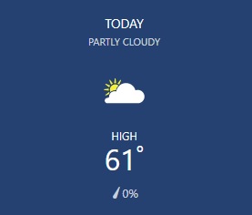
afternoon highs mostly in the low to mid 60s.
Surface high center sliding into New England this evening will result in
a CAD wedge building in for Sunday across the area. We can expect a
shift to cooler temps (about 10 degrees lower than Saturday across
north GA), increased easterly gradient winds, and some low level
moisture overrunning/isentropic upglide causing increased cloud
coverage and some return of afternoon shower potential in parts of
the south and west. Ascent and late shower potential could also be
aided by a weak upper shortwave.
Baker
LONG TERM /Sunday Night through Friday/…
The long term period begins on Sunday night with a wedge still in
place across northeast Georgia. As southwest flow advects moisture
over the wedge, chances for showers will continue into the early
hours on Monday. Have included slight chance pops for Sunday
afternoon with increasing chances Sunday night into Monday
afternoon, as the wedge breaks down. A large longwave trough will
push a strong cold front towards the area on Tuesday into Wednesday
with the arrival of the front during the day on Wednesday. Have
included chance pops across much of the area with likely pops across
portions of northern Georgia in addition to the mountains. The
highest QPF amounts for Monday through Wednesday look to be across
far northern Georgia, around 1 to 2 inches with around a half inch
or less further south. In addition, models are showing some slight
differences on the backside of this system with the GFS showing
another shortwave trough developing and crossing the local forecast
area late Wednesday into Thursday and the ECMWF, while still showing
the shortwave trough, clears precip from the local forecast area by
Thursday and takes the trough much further south of the area.
Overall, decided to trend on the drier side for pops in this time
period, with slight chance to chance pops Wednesday afternoon and
clearing across the area on Thursday.
Post frontal passage, high pressure will build into the area at the
surface, providing dry weather for Thursday. By Friday, chances for
precipitation will increase again as models show a developing
surface low in the Gulf moving towards the local forecast area on
Friday and Saturday. Although models are showing some differences in
timing, have included chance pops for Friday through the early
weekend.
High temperatures on Monday and Tuesday will be about 5 to 15
degrees above average in the 60s and 70s, returning to the 40s and
50s through the rest of the extended. Overnight lows Tuesday morning
will be very warm in the 50s and 60s, around 20 to 25 degrees above
average. Otherwise, lows through the rest of the extended are
expected to be in the 30s and 40s.
Reaves
Notice in the 2nd paragraph the abbreviation CAD.
CAD stands for ” Cold Air Damming. The phenomenon in which a low-level cold air mass is trapped topographically. Often, this cold air is entrenched on the east side of mountainous terrain. Cold Air Damming often implies that the trapped cold air mass is influencing the dynamics of the overlying air mass, e.g. in an overrunning scenario. Effects on the weather may include cold temperatures, freezing precipitation, and extensive cloud cover.”
Good Grief.
I can see why they used the abbreviation.
These are some of the words used in just the short term forecast.
lingering
secondary
weak
upper
isolated
light
mainly
early
mid
especially
fairly
pleasant
mostly
low
mid
high
cooler
lower
increased
easterly
gradient
overrunning
isentropic
upglide
Impressive list.
Notice also the names Baker and Reeves and the end of the forecasts.
Are these the meteorologist who wrote these forecasts?
Did they learn this style in meteorology class?
Is there a special thesaurus for weather modifiers?
At the end, what do want to know?

I take my hat off to these people.
I salute these people.
I also recall once seeing my good friend George Lessens come into the newsroom after a particularity wordy forecast and I yelled, “oh come on. You guys make all the stuff up!”
Even George joined in as everyone in the newsroom laughed.